FieldCam
Professional Geotagging & Field Documentation
The essential iOS app for field professionals, researchers, and students. Capture GPS-tagged photos, organize field documentation, and export location data with professional precision.
Professional Geotagging Made Simple
Powerful tools for field documentation and location-based project management
GPS Precision
Capture exact field locations with high-precision GPS coordinates, enabling accurate site documentation and return visits.
Smart Photo Organization
Organize photos by project folders with automatic GPS tagging, timestamps, and comprehensive metadata preservation.
Professional Export
Export your geotagged photos to KML/KMZ format for integration with Google Earth, ArcGIS, and other mapping platforms.
Project Management
Create and manage multiple projects with folder-based organization, making it easy to track different field sites.
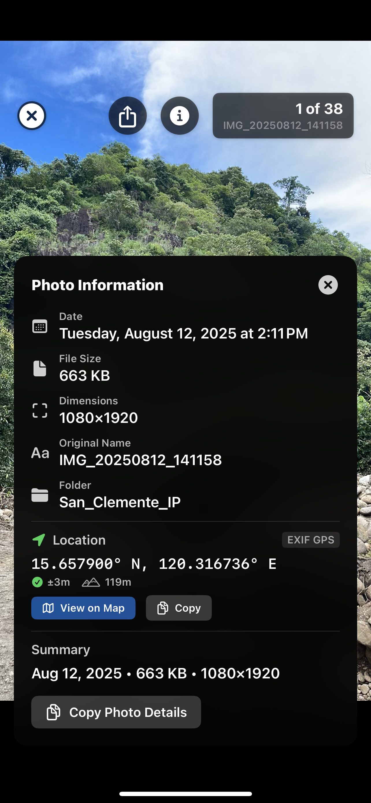
Location Analysis
View detailed location information including coordinates, altitude, and address resolution for comprehensive documentation.
Privacy First
All data stays on your device with full user control over location sharing and data export - no cloud storage required.
Perfect for Your Field Work
🎓 Students & Researchers
Document field studies, research sites, and academic projects with precise GPS coordinates and organized photo collections.
🏗️ Engineers & Surveyors
Conduct site assessments, document existing conditions, and create location-based project archives for infrastructure work.
🌿 Environmental Scientists
Track environmental conditions, monitor field sites, and maintain detailed location records for ecological studies.
🔬 Field Professionals
Organize multi-site projects, document field conditions, and export data for analysis in professional GIS software.
Technical Capabilities
GPS & Location
- High-precision GPS coordinates
- Automatic location tagging
- Altitude and accuracy tracking
- Address resolution and geocoding
- Location privacy controls
Photo Management
- Project-based organization
- Automatic thumbnail generation
- EXIF metadata preservation
- Batch import and export
- High-resolution image capture
Data Export
- KML/KMZ for Google Earth
- GPS-tagged photo collections
- Metadata preservation
- Professional mapping formats
- GIS software compatibility
App Screenshots
See FieldCam in action
Project Organization
Organize your field work by projects and locations
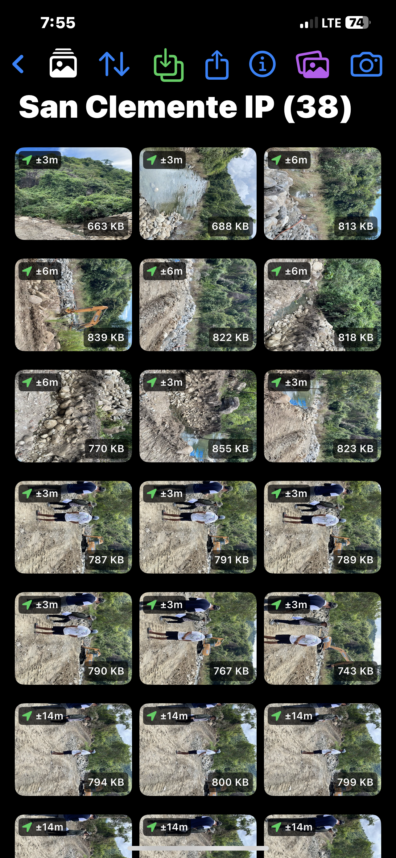
Photo Capture
Capture photos with precise GPS location data
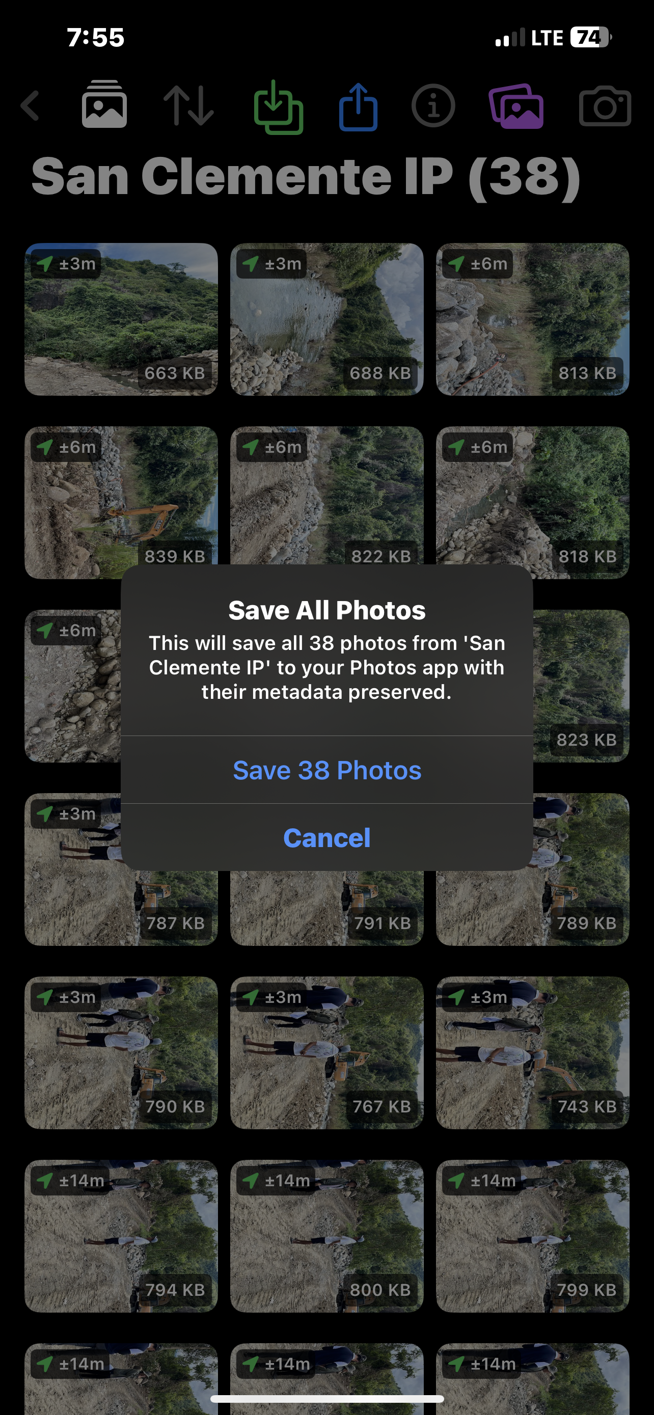
Photo Gallery
Browse your geotagged photo collections
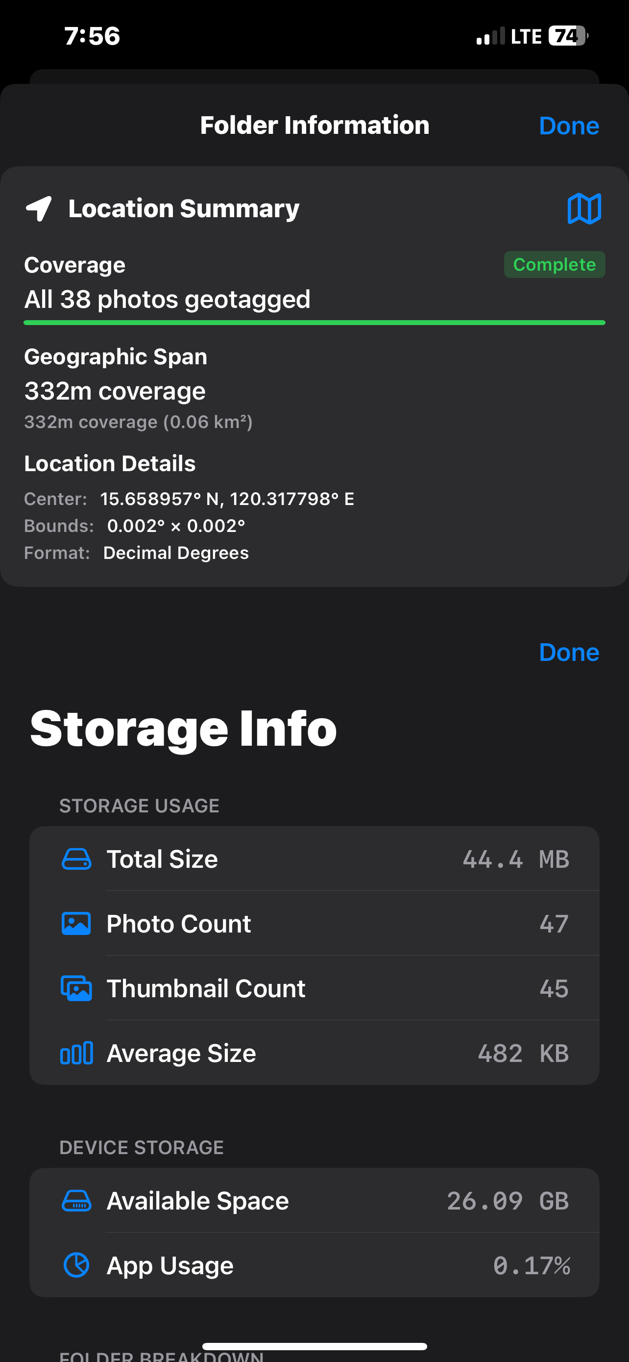
Location Details
View detailed GPS coordinates and metadata
Settings
Configure location privacy and app preferences
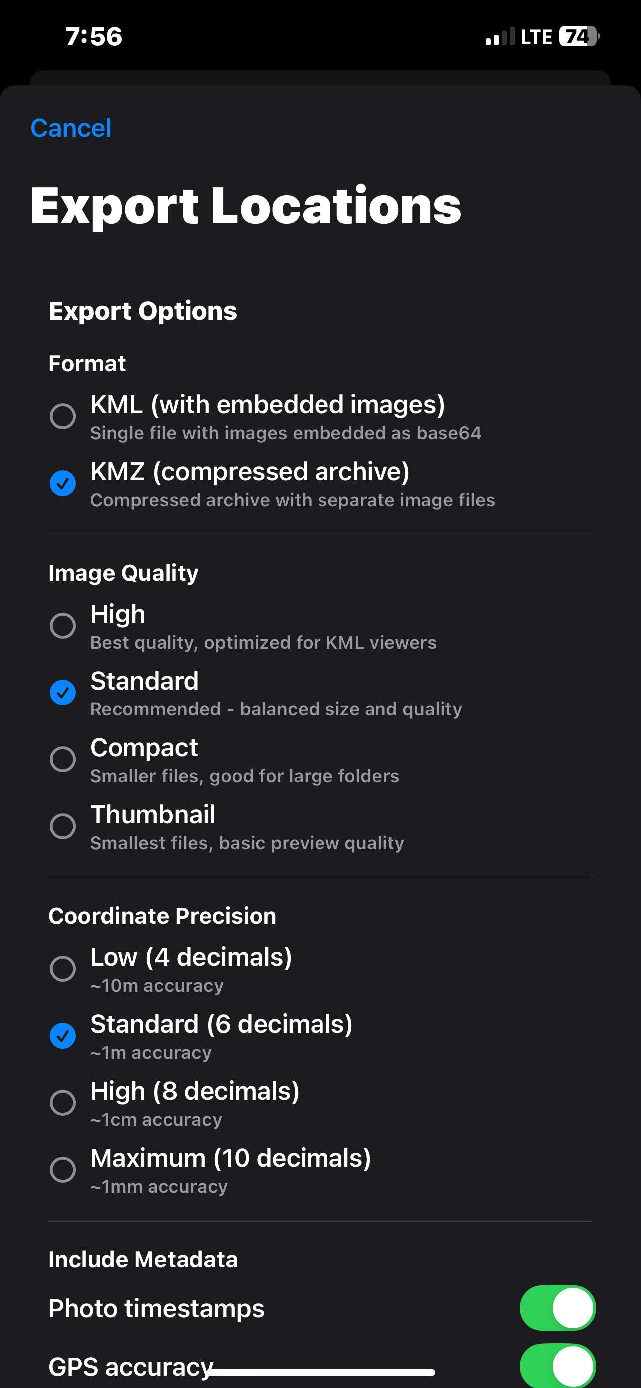
Export Options
Export to Google Earth and mapping software
Get FieldCam Today
Available exclusively for iPhone

System Requirements
- iOS 15.0 or later
- iPhone only
- GPS capability recommended
- Camera access required